


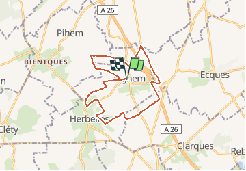
Inghem 13Kms (Dén P 145m)

alain62rando
User

Length
12.9 km

Max alt
93 m

Uphill gradient
145 m
Km-Effort
14.8 km

Min alt
42 m

Downhill gradient
145 m
Boucle
Yes
Creation date :
2020-05-28 10:54:35.69
Updated on :
2020-05-31 04:23:01.913
3h15
Difficulty : Medium

FREE GPS app for hiking
 SityTrail
IGN / Geographical institutes
SityTrail Plus
The world is yours!
About
Trail Walking of 12.9 km to be discovered at Hauts-de-France, Pas-de-Calais, Bellinghem. This trail is proposed by alain62rando.
Description
Départ parking de l'église
Positioning
Country:
France
Region :
Hauts-de-France
Department/Province :
Pas-de-Calais
Municipality :
Bellinghem
Location:
Unknown
Start:(Dec)
Start:(UTM)
446445 ; 5613161 (31U) N.
Comments