


st Julien en quint but st genis

Joel26400
User
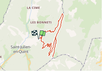

Length
20 km

Max alt
1619 m

Uphill gradient
1069 m
Km-Effort
34 km

Min alt
677 m

Downhill gradient
1069 m
Boucle
Yes
Creation date :
2020-05-28 07:02:27.343
Updated on :
2020-05-28 16:28:27.181
8h09
Difficulty : Difficult

FREE GPS app for hiking
 SityTrail
IGN / Geographical institutes
SityTrail Plus
The world is yours!
About
Trail Walking of 20 km to be discovered at Auvergne-Rhône-Alpes, Drôme, Saint-Julien-en-Quint. This trail is proposed by Joel26400.
Description
rando en sous bois. pierrier
Positioning
Country:
France
Region :
Auvergne-Rhône-Alpes
Department/Province :
Drôme
Municipality :
Saint-Julien-en-Quint
Location:
Unknown
Start:(Dec)
Start:(UTM)
682903 ; 4968377 (31T) N.
Comments