


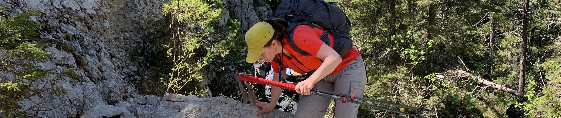
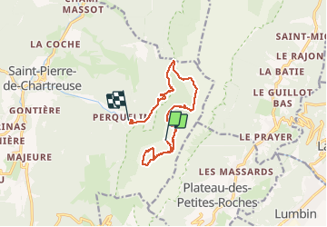
Chartreuse Perquelin arche+chaos de bellefond

c.gourme
User

Length
13 km

Max alt
1790 m

Uphill gradient
592 m
Km-Effort
23 km

Min alt
997 m

Downhill gradient
1140 m
Boucle
No
Creation date :
2020-05-28 08:23:28.0
Updated on :
2020-05-28 18:23:24.644
6h33
Difficulty : Difficult

FREE GPS app for hiking
 SityTrail
IGN / Geographical institutes
SityTrail Plus
The world is yours!
About
Trail Walking of 13 km to be discovered at Auvergne-Rhône-Alpes, Isère, Saint-Pierre-de-Chartreuse. This trail is proposed by c.gourme.
Photos


Positioning
Country:
France
Region :
Auvergne-Rhône-Alpes
Department/Province :
Isère
Municipality :
Saint-Pierre-de-Chartreuse
Location:
Unknown
Start:(Dec)
Start:(UTM)
724233 ; 5023116 (31T) N.
Comments