


Montrieux- Les Tirassades-Vallon du Rayol

francisdean
User
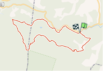

Length
11.5 km

Max alt
452 m

Uphill gradient
268 m
Km-Effort
15 km

Min alt
232 m

Downhill gradient
267 m
Boucle
Yes
Creation date :
2020-05-29 17:02:21.961
Updated on :
2020-05-29 17:09:07.852
3h12
Difficulty : Easy

FREE GPS app for hiking
 SityTrail
IGN / Geographical institutes
SityTrail Plus
The world is yours!
About
Trail Walking of 11.5 km to be discovered at Provence-Alpes-Côte d'Azur, Var, Méounes-lès-Montrieux. This trail is proposed by francisdean.
Positioning
Country:
France
Region :
Provence-Alpes-Côte d'Azur
Department/Province :
Var
Municipality :
Méounes-lès-Montrieux
Location:
Unknown
Start:(Dec)
Start:(UTM)
740492 ; 4794336 (31T) N.
Comments