


Rocher de Gloritte depart Ribiers

claude nier
User
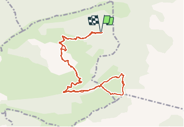

Length
12.8 km

Max alt
1352 m

Uphill gradient
424 m
Km-Effort
18.5 km

Min alt
1113 m

Downhill gradient
420 m
Boucle
Yes
Creation date :
2020-05-29 07:27:03.946
Updated on :
2020-05-31 09:33:48.763
4h50
Difficulty : Medium

FREE GPS app for hiking
 SityTrail
IGN / Geographical institutes
SityTrail Plus
The world is yours!
About
Trail Walking of 12.8 km to be discovered at Provence-Alpes-Côte d'Azur, Hautes-Alpes, Éourres. This trail is proposed by claude nier.
Description
petite rando sympa..beau panorama
Positioning
Country:
France
Region :
Provence-Alpes-Côte d'Azur
Department/Province :
Hautes-Alpes
Municipality :
Éourres
Location:
Unknown
Start:(Dec)
Start:(UTM)
722624 ; 4901083 (31T) N.
Comments