Trail Walking Bury - brivois et bailleval - Photo

brivois et bailleval

© OpenStreetMap contributors
Length
Length
12.8 km
Max alt
Max alt
129 m
Uphill gradient
Uphill gradient
230 m
Km-Effort
Km-Effort  
15.9 km
Min alt
Min alt
41 m
Downhill gradient
Downhill gradient
241 m
Boucle
Boucle
No
Creation date :
2014-12-10 00:00:00.0
Updated on :
2014-12-10 00:00:00.0

(0 Reviews)

Walking
Walking
1h29
Difficulty : Easy

Scan this QR Code to open this trail in the SityTrail application

FREE GPS app for hiking

Logo SityTrail SityTrail

IGN / Geographical institutes

Download SityTrail from the App Store Download SityTrail from Google Play

Logo SityTrail SityTrail World

The world is yours!

Download SityTrail from the App Store Download SityTrail from Google Play Download SityTrail on Huawei AppGallery

About

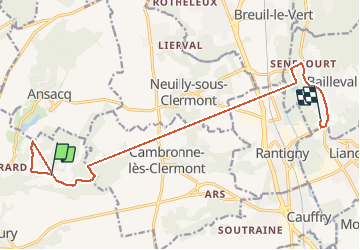
Trail Walking of 12.8 km to be discovered at Hauts-de-France, Oise, Bury. This trail is proposed by solognac@netcourrier.com.

Elevation profile

Positioning

Country:
France
Region :
Hauts-de-France
Department/Province :
Oise
Municipality :
Bury
Location:
Unknown
Start:(UTM)
453565 ; 5463913 (31U) N.

Trails nearby

Trail Walking Bury - Bury_Trace GPS_8,9 km - Photo
Walking
Pousscailleux

Walking

Medium
(1)
Bury, Hauts-de-France, Oise, France
8.9 km | 11.1 km-effort
2h 25min
Yes
Trail Walking Rantigny - Vaux Cambrone - Photo
Walking
Laigneville159-

Walking

Rantigny, Hauts-de-France, Oise, France
8 km | 9.9 km-effort
2h 27min
Yes
Trail Walking Breuil-le-Vert - chatelier - Photo
Walking
jacfric

Walking

Easy
Breuil-le-Vert, Hauts-de-France, Oise, France
5 km | 6.2 km-effort
1h 8min
Yes
Trail Walking Cambronne-lès-Clermont - Ars - Photo
Walking
Francine

Walking

Medium
Cambronne-lès-Clermont, Hauts-de-France, Oise, France
14.2 km | 16.8 km-effort
3h 39min
Yes
Trail Walking Neuilly-sous-Clermont - Neuillysous Clermont - Photo
Walking
Francine

Walking

Difficult
Neuilly-sous-Clermont, Hauts-de-France, Oise, France
15 km | 17.9 km-effort
3h 54min
Yes
Trail Walking Neuilly-sous-Clermont - Neuillysous Clermont - Photo
Walking
Francine

Walking

Difficult
Neuilly-sous-Clermont, Hauts-de-France, Oise, France
15 km | 17.9 km-effort
3h 54min
Yes
Trail Walking Rantigny - Rantigny_La croix de VauxTrace GPS simplifiée_9,0 km - Photo
Walking
Pousscailleux

Walking

Easy
Rantigny, Hauts-de-France, Oise, France
8.9 km | 10.6 km-effort
2h 12min
Yes
Trail Walking Cambronne-lès-Clermont - Cambronne-Lès-Clermont_La vallée de Vaux_8,3 km - Photo
Walking
Pousscailleux

Walking

Medium
(1)
Cambronne-lès-Clermont, Hauts-de-France, Oise, France
8.3 km | 10.3 km-effort
2h 14min
Yes
Trail Walking Rantigny - Rantigny_La Vallée de Vaux_8,1 km - Photo
Walking
Pousscailleux

Walking

Easy
Rantigny, Hauts-de-France, Oise, France
8 km | 9.9 km-effort
2h 2min
Yes


Close
My subscriptions