


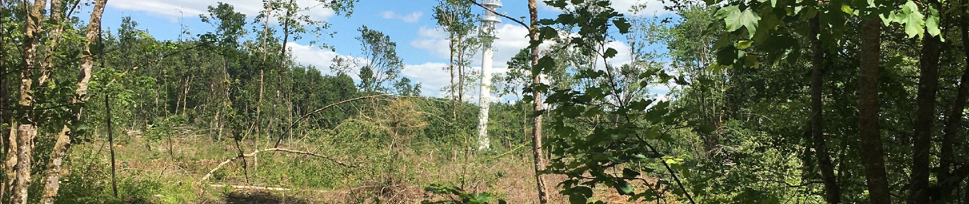
Forêt de Preny dévastée quelle dommage

bitiba
User

Length
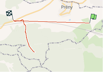
7.4 km

Max alt
373 m

Uphill gradient
214 m
Km-Effort
9.7 km

Min alt
204 m

Downhill gradient
60 m
Boucle
No
Creation date :
2020-05-31 11:58:56.0
Updated on :
2020-05-31 13:13:41.898
1h14
Difficulty : Medium

FREE GPS app for hiking
 SityTrail
IGN / Geographical institutes
SityTrail Plus
The world is yours!
About
Trail Walking of 7.4 km to be discovered at Grand Est, Meurthe-et-Moselle, Prény. This trail is proposed by bitiba.
Description
Beau temps mais grand vent frais
Photos


Positioning
Country:
France
Region :
Grand Est
Department/Province :
Meurthe-et-Moselle
Municipality :
Prény
Location:
Unknown
Start:(Dec)
Start:(UTM)
281221 ; 5428676 (32U) N.
Comments