


lac des meinettes

Steph0726
User
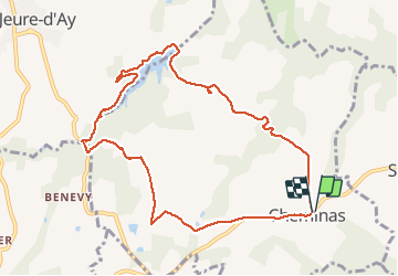

Length
10.3 km

Max alt
486 m

Uphill gradient
154 m
Km-Effort
12.4 km

Min alt
395 m

Downhill gradient
154 m
Boucle
Yes
Creation date :
2020-05-31 11:35:46.025
Updated on :
2020-05-31 15:32:53.43
3h06
Difficulty : Very easy

FREE GPS app for hiking
 SityTrail
IGN / Geographical institutes
SityTrail Plus
The world is yours!
About
Trail Walking of 10.3 km to be discovered at Auvergne-Rhône-Alpes, Ardèche, Cheminas. This trail is proposed by Steph0726.
Positioning
Country:
France
Region :
Auvergne-Rhône-Alpes
Department/Province :
Ardèche
Municipality :
Cheminas
Location:
Unknown
Start:(Dec)
Start:(UTM)
637849 ; 4998355 (31T) N.
Comments
ok, très joli, possiblr en 2h environ