Trail Walking Moyenvic - les hauts de Sain-Jean - Photo

les hauts de Sain-Jean

 viverols
viverols

User

© OpenStreetMap contributors
Length
Length
7.2 km
Max alt
Max alt
306 m
Uphill gradient
Uphill gradient
137 m
Km-Effort
Km-Effort  
9.1 km
Min alt
Min alt
201 m
Downhill gradient
Downhill gradient
141 m
Boucle
Boucle
Yes
Creation date :
2020-05-31 14:13:51.798
Updated on :
2020-05-31 16:23:32.717

(1 Reviews)

Walking
Walking
2h00
Difficulty : Very easy

Scan this QR Code to open this trail in the SityTrail application

FREE GPS app for hiking

Logo SityTrail SityTrail

IGN / Geographical institutes

Download SityTrail from the App Store Download SityTrail from Google Play

Logo SityTrail SityTrail World

The world is yours!

Download SityTrail from the App Store Download SityTrail from Google Play Download SityTrail on Huawei AppGallery

About

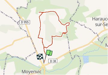
Trail Walking of 7.2 km to be discovered at Grand Est, Moselle, Moyenvic. This trail is proposed by viverols.

Description

circuit historique sur les hauteurs de Moyenvic

Elevation profile

Photos

Positioning

Country:
France
Region :
Grand Est
Department/Province :
Moselle
Municipality :
Moyenvic
Location:
Unknown
Start:(UTM)
321513 ; 5406315 (32U) N.

Comments

Please log in to post a review or rate the element


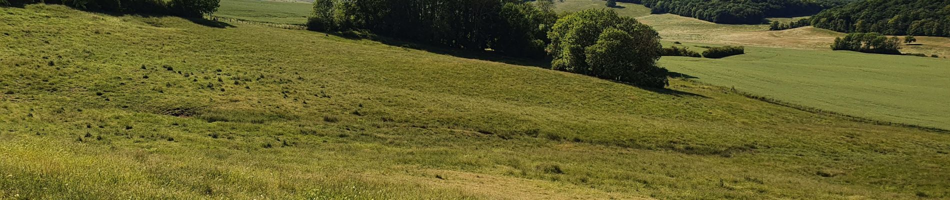
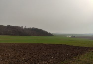
Très beau circuit bucolique facile dans le sens des aiguilles d'une montre. A l'intersection avec le GR5 une grande table de 10 places abritée domine la plaine. La chapelle St Livier, la table d'orientation , l'abri sont les points forts du circuit. Les sentiers des bois environnants permettent de rallonger la randonnée. alain


Trails nearby

Trail Walking Saint-Médard - marche de Saint Medard - Photo
Walking
didier cornelius

Walking

Easy
Saint-Médard, Grand Est, Moselle, France
10.9 km | 13.2 km-effort
3h 53min
Yes
Trail Cycle Château-Salins - Le Pays du Saulnois,  l'histoire du sel. (Circuit 17) - Photo
Cycle
tracegps

Cycle

Difficult
(1)
Château-Salins, Grand Est, Moselle, France
52 km | 62 km-effort
3h 0min
Yes
Trail Walking Vic-sur-Seille - Bezange la Grande - Photo
Walking
didier cornelius

Walking

Easy
Vic-sur-Seille, Grand Est, Moselle, France
11 km | 13.4 km-effort
2h 10min
Yes
Trail Walking Château-Salins - Vic sur seille au départ de Château Salins  - Photo
Walking
jean-marie.parachini

Walking

Medium
Château-Salins, Grand Est, Moselle, France
18.9 km | 23 km-effort
6h 35min
Yes
Trail Walking Moyenvic - boucle départ moyenvic  - Photo
Walking
bellophilippe

Walking

Very difficult
Moyenvic, Grand Est, Moselle, France
27 km | 33 km-effort
5h 22min
Yes
Trail Walking Vic-sur-Seille - vic moyenvic par stade - Photo
Walking
bellophilippe

Walking

Easy
Vic-sur-Seille, Grand Est, Moselle, France
4.2 km | 4.8 km-effort
54min
No
Trail Walking Moyenvic - Moyenvic vic boucle  - Photo
Walking
bellophilippe

Walking

Medium
Moyenvic, Grand Est, Moselle, France
14.8 km | 18.5 km-effort
3h 24min
Yes
Trail Walking Moyenvic - sortie du 20923 - Photo
Walking
bellophilippe

Walking

Medium
Moyenvic, Grand Est, Moselle, France
14.7 km | 17 km-effort
3h 24min
Yes
Trail Walking Haraucourt-sur-Seille - Haraucourt sur seille - Photo
Walking
didier cornelius

Walking

Medium
Haraucourt-sur-Seille, Grand Est, Moselle, France
13.4 km | 16.5 km-effort
3h 57min
Yes


Close
My subscriptions