


activity_5024063068

fabienlepetitsuisse
User

Length
12 km

Max alt
1887 m

Uphill gradient
943 m
Km-Effort
25 km

Min alt
997 m

Downhill gradient
951 m
Boucle
Yes
Creation date :
2020-06-01 17:35:55.935
Updated on :
2020-06-01 17:40:46.908
--
Difficulty : Medium

FREE GPS app for hiking
 SityTrail
IGN / Geographical institutes
SityTrail Plus
The world is yours!
About
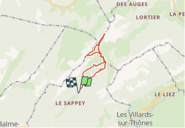
Trail Walking of 12 km to be discovered at Auvergne-Rhône-Alpes, Upper Savoy, Thônes. This trail is proposed by fabienlepetitsuisse.
Description
Belle vu sur le plateau des Glieres et les Aravis
Positioning
Country:
France
Region :
Auvergne-Rhône-Alpes
Department/Province :
Upper Savoy
Municipality :
Thônes
Location:
Unknown
Start:(Dec)
Start:(UTM)
292465 ; 5088310 (32T) N.
Comments