


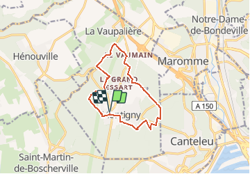
Autour de Montigny

JMCMoreau
User

Length
11.1 km

Max alt
147 m

Uphill gradient
176 m
Km-Effort
13.4 km

Min alt
70 m

Downhill gradient
176 m
Boucle
Yes
Creation date :
2020-06-04 16:08:11.837
Updated on :
2020-06-04 16:28:09.532
3h00
Difficulty : Easy

FREE GPS app for hiking
 SityTrail
IGN / Geographical institutes
SityTrail Plus
The world is yours!
About
Trail Walking of 11.1 km to be discovered at Normandy, Seine-Maritime, Montigny. This trail is proposed by JMCMoreau.
Description
Boucle de 11Km autour de Montigny. Balade essentiellement en forêt. Beaucoup de sentiers et routes forestières peu de bitume. A faire en famille ou marcheurs sur la 1/2 journée à proximité de Rouen.
Positioning
Country:
France
Region :
Normandy
Department/Province :
Seine-Maritime
Municipality :
Montigny
Location:
Unknown
Start:(Dec)
Start:(UTM)
354684 ; 5480549 (31U) N.
Comments