Trail Walking Crécy-la-Chapelle - Les coteaux du Grand Morin - Photo
 Bntg
Bntg

User

© OpenStreetMap contributors
Length
Length
11.8 km
Max alt
Max alt
132 m
Uphill gradient
Uphill gradient
189 m
Km-Effort
Km-Effort  
14.3 km
Min alt
Min alt
47 m
Downhill gradient
Downhill gradient
189 m
Boucle
Boucle
Yes
Creation date :
2020-06-04 20:39:20.893
Updated on :
2020-07-28 01:14:06.962

(0 Reviews)

Walking
Walking
3h06
Difficulty : Medium

Scan this QR Code to open this trail in the SityTrail application

FREE GPS app for hiking

Logo SityTrail SityTrail

IGN / Geographical institutes

Download SityTrail from the App Store Download SityTrail from Google Play

Logo SityTrail SityTrail World

The world is yours!

Download SityTrail from the App Store Download SityTrail from Google Play Download SityTrail on Huawei AppGallery

About

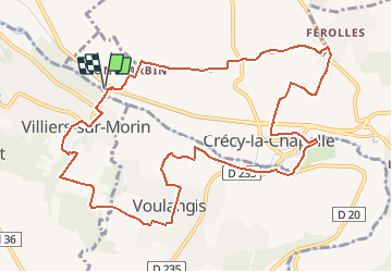
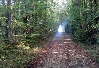
Trail Walking of 11.8 km to be discovered at Ile-de-France, Seine-et-Marne, Crécy-la-Chapelle. This trail is proposed by Bntg.

Description

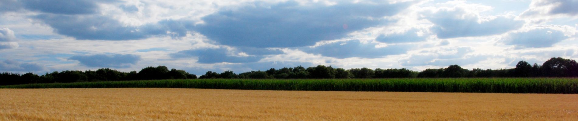
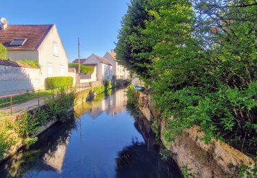
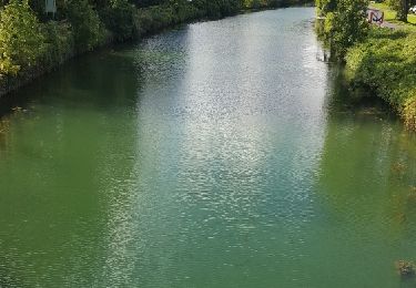
Une randonnée à recommander avec aussi bien des sous-bois, des communes agréables, des chemins à travers champs, des cours d’eau et bien sûr Le Grand-Morin.
Nous l’avons faite fin juillet et toutes les cultures céréalières n’étant pas encore rentrées, le coup d’œil et les couleurs étaient magnifiques. Qu’en sera-t-il à d’autres saisons ?
De même, tous les chemins son praticables par temps sec mais je pense que certains passages sont à éviter juste après la saison des pluies (notamment le dernier quart).

Elevation profile

Photos

Positioning

Country:
France
Region :
Ile-de-France
Department/Province :
Seine-et-Marne
Municipality :
Crécy-la-Chapelle
Location:
Unknown
Start:(UTM)
491400 ; 5412260 (31U) N.

Trails nearby

Trail Walking Crécy-la-Chapelle - Crécy la Chapelle Parcours normal - Photo
Walking
CC.RIDER

Walking

Easy
(1)
Crécy-la-Chapelle, Ile-de-France, Seine-et-Marne, France
16.1 km | 19.5 km-effort
4h 18min
Yes
Trail Walking Crécy-la-Chapelle - Crécy la chapelle - Photo
Walking
CC.RIDER

Walking

Easy
(2)
Crécy-la-Chapelle, Ile-de-France, Seine-et-Marne, France
19.7 km | 24 km-effort
5h 12min
Yes
Trail Walking Crécy-la-Chapelle - Crécy la Chapelle - Photo
Walking
jctinchebray

Walking

Medium
(1)
Crécy-la-Chapelle, Ile-de-France, Seine-et-Marne, France
16.4 km | 20 km-effort
4h 23min
Yes
Trail Walking Crécy-la-Chapelle - Autour de Tigeaux - Photo
Walking
em77

Walking

Medium
(2)
Crécy-la-Chapelle, Ile-de-France, Seine-et-Marne, France
13.2 km | 16.5 km-effort
2h 37min
Yes
Trail Walking Crécy-la-Chapelle - Boucle 28 km autour de Crecy la Chapelle - Guérard - Voulangis - Tigeaux - Photo
Walking
chessyca

Walking

Medium
Crécy-la-Chapelle, Ile-de-France, Seine-et-Marne, France
28 km | 35 km-effort
5h 46min
Yes
Trail Walking Tigeaux - Tigeaux - Photo
Walking
Tournan

Walking

Medium
(1)
Tigeaux, Ile-de-France, Seine-et-Marne, France
19.1 km | 24 km-effort
5h 24min
Yes
Trail Walking Esbly - Esbly -Couilly - Quincy - Photo
Walking
Tournan

Walking

Easy
(1)
Esbly, Ile-de-France, Seine-et-Marne, France
14.1 km | 16.5 km-effort
3h 44min
Yes
Trail Walking Condé-Sainte-Libiaire - CRAB :
Walking
PatRando

Walking

Easy
Condé-Sainte-Libiaire, Ile-de-France, Seine-et-Marne, France
20 km | 24 km-effort
4h 18min
Yes
Trail Walking Bouleurs - Bouleurs - Photo
Walking
PatRando

Walking

Easy
Bouleurs, Ile-de-France, Seine-et-Marne, France
16.4 km | 18.6 km-effort
4h 5min
Yes


Close
My subscriptions