


bueges

Bwattier
User
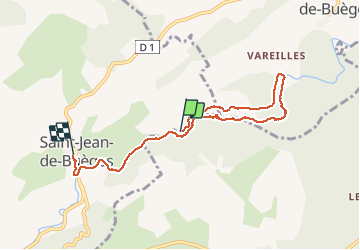

Length
6.9 km

Max alt
184 m

Uphill gradient
106 m
Km-Effort
8.3 km

Min alt
129 m

Downhill gradient
91 m
Boucle
No
Creation date :
2020-06-06 10:26:12.407
Updated on :
2020-06-06 13:49:39.424
2h53
Difficulty : Very easy

FREE GPS app for hiking
 SityTrail
IGN / Geographical institutes
SityTrail Plus
The world is yours!
About
Trail Walking of 6.9 km to be discovered at Occitania, Hérault, Saint-Jean-de-Buèges. This trail is proposed by Bwattier.
Positioning
Country:
France
Region :
Occitania
Department/Province :
Hérault
Municipality :
Saint-Jean-de-Buèges
Location:
Unknown
Start:(Dec)
Start:(UTM)
551116 ; 4853334 (31T) N.
Comments