


Etape 6 jusqu ' orri des legunes

nico64160
User
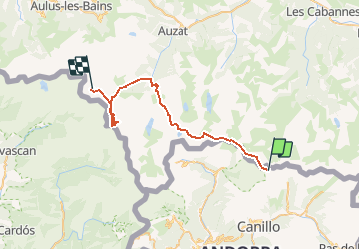

Length
37 km

Max alt
3095 m

Uphill gradient
4179 m
Km-Effort
95 km

Min alt
1026 m

Downhill gradient
4768 m
Boucle
No
Creation date :
2020-06-07 20:38:13.803
Updated on :
2020-06-09 11:33:50.972
15h53
Difficulty : Very difficult

FREE GPS app for hiking
 SityTrail
IGN / Geographical institutes
SityTrail Plus
The world is yours!
About
Trail Walking of 37 km to be discovered at Andorra. This trail is proposed by nico64160.
Positioning
Country:
Andorra
Region :
Unknown
Department/Province :
Unknown
Municipality :
Unknown
Location:
Unknown
Start:(Dec)
Start:(UTM)
386063 ; 4719908 (31T) N.
Comments