Trail Walking Saint-Ours - 
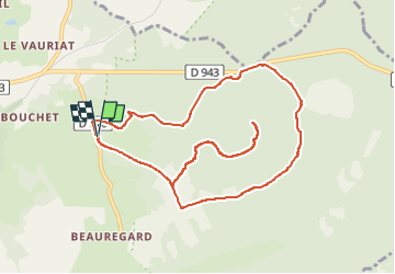
Beauregard_Louchadiere_2 - Photo
 jagarnier
jagarnier

User GUIDE

© OpenStreetMap contributors
Length
Length
10.8 km
Max alt
Max alt
1194 m
Uphill gradient
Uphill gradient
388 m
Km-Effort
Km-Effort  
16 km
Min alt
Min alt
899 m
Downhill gradient
Downhill gradient
390 m
Boucle
Boucle
Yes
Creation date :
2020-06-10 05:52:16.848
Updated on :
2022-06-08 07:14:48.13

(0 Reviews)

Walking
Walking
3h15
Difficulty : Medium

Scan this QR Code to open this trail in the SityTrail application

FREE GPS app for hiking

Logo SityTrail SityTrail

IGN / Geographical institutes

Download SityTrail from the App Store Download SityTrail from Google Play

Logo SityTrail SityTrail Plus

The world is yours!

Download SityTrail from the App Store Download SityTrail from Google Play Download SityTrail on Huawei AppGallery

About

Trail Walking of 10.8 km to be discovered at Auvergne-Rhône-Alpes, Puy-de-Dôme, Saint-Ours. This trail is proposed by jagarnier.

Description

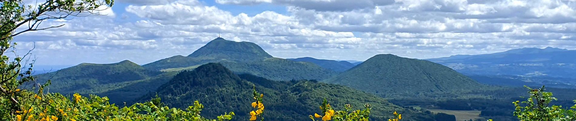
A 1 198 m, le sommet du Puy de Louchadière et son cône égueulé offre un terrain de jeu à une faune variée. Jolis points de vue sur la chaîne des Puys et sur les puys de Sarcoui, Goules, Gouttes, Fraisse, Clerziou, Grand Suchet et Puy de Dôme.

Elevation profile

Photos

Positioning

Country:
France
Region :
Auvergne-Rhône-Alpes
Department/Province :
Puy-de-Dôme
Municipality :
Saint-Ours
Location:
Unknown
Start:(UTM)
494267 ; 5077571 (31T) N.


Close
My subscriptions