


Cime de tuors

Arnaud Stévenard
User

Length
22 km

Max alt
2125 m

Uphill gradient
1247 m
Km-Effort
39 km

Min alt
984 m

Downhill gradient
1243 m
Boucle
Yes
Creation date :
2020-06-14 06:24:00.0
Updated on :
2020-06-14 15:05:21.364
8h39
Difficulty : Difficult

FREE GPS app for hiking
 SityTrail
IGN / Geographical institutes
SityTrail Plus
The world is yours!
About
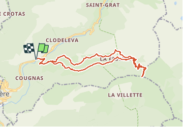
Trail Walking of 22 km to be discovered at Provence-Alpes-Côte d'Azur, Maritime Alps, Belvédère. This trail is proposed by Arnaud Stévenard.
Positioning
Country:
France
Region :
Provence-Alpes-Côte d'Azur
Department/Province :
Maritime Alps
Municipality :
Belvédère
Location:
Unknown
Start:(Dec)
Start:(UTM)
366961 ; 4876488 (32T) N.
Comments