


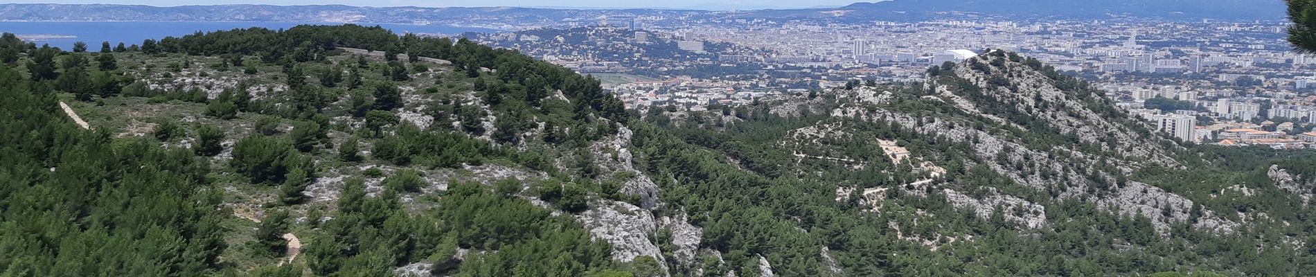
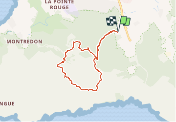
Fontaine de Voire - Puit du lierre - col de la selle - Malvallon sud

fhascoet
User


3h30
Difficulty : Medium

FREE GPS app for hiking
 SityTrail
IGN / Geographical institutes
SityTrail Plus
The world is yours!
About
Trail Walking of 7.5 km to be discovered at Provence-Alpes-Côte d'Azur, Bouches-du-Rhône, Marseille. This trail is proposed by fhascoet.
Description
Ballade avec vue sur Marseille au début puis vue sur la mer et les Iles à partir du Col de la Selle. Arrivée du chemin vert au dessus de la fontaine de Voire très raide et glissant à cause des cailloux.
Photos


Positioning
Comments