


Lac Bleu, Lac Vert depuis le Chiroulet

lhomme.ph
User GUIDE
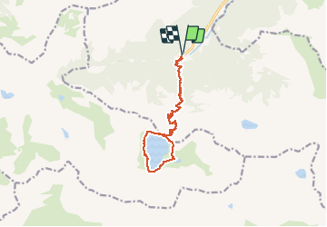

Length
14.8 km

Max alt
2071 m

Uphill gradient
1108 m
Km-Effort
30 km

Min alt
1066 m

Downhill gradient
1109 m
Boucle
Yes
Creation date :
2020-06-14 06:40:19.688
Updated on :
2020-06-26 12:27:52.001
8h33
Difficulty : Medium

FREE GPS app for hiking
 SityTrail
IGN / Geographical institutes
SityTrail Plus
The world is yours!
About
Trail Walking of 14.8 km to be discovered at Occitania, Hautespyrenees, Bagnères-de-Bigorre. This trail is proposed by lhomme.ph.
Positioning
Country:
France
Region :
Occitania
Department/Province :
Hautespyrenees
Municipality :
Bagnères-de-Bigorre
Location:
Unknown
Start:(Dec)
Start:(UTM)
262646 ; 4760738 (31T) N.
Comments