


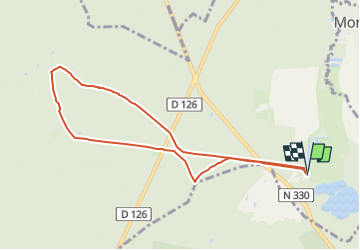
Abbaye de Chaalis+fiche+GPX_ 7,8Km_SM

GOELE RANDO
Randonner avec bonne humeur et convivialité. (Inscription réservée uniquement aux animateurs de GOËLE RANDO)


2h02
Difficulty : Medium

FREE GPS app for hiking
 SityTrail
IGN / Geographical institutes
SityTrail Plus
The world is yours!
About
Trail Walking of 7.9 km to be discovered at Hauts-de-France, Oise, Fontaine-Chaalis. This trail is proposed by GOELE RANDO.
Description
http://www.goelerando.fr/
Dammartin-en-Goële 77230
Photos

Positioning
Comments
super