


Bielsa Muro 19 Octobre 2013

harydh
User GUIDE
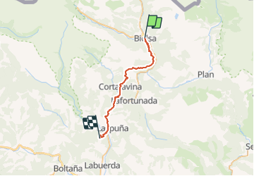

Length
29 km

Max alt
1341 m

Uphill gradient
1324 m
Km-Effort
47 km

Min alt
600 m

Downhill gradient
1404 m
Boucle
No
Creation date :
2020-06-18 10:42:13.71
Updated on :
2021-06-23 11:00:50.194
9h33
Difficulty : Very difficult

FREE GPS app for hiking
 SityTrail
IGN / Geographical institutes
SityTrail Plus
The world is yours!
About
Trail Walking of 29 km to be discovered at Aragon, Huesca, Bielsa. This trail is proposed by harydh.
Description
Long Long Long Long......
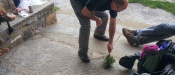
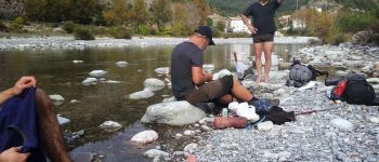
Photos


23 photos in total. Please click on a photo to see them all in the gallery.


Positioning
Country:
Spain
Region :
Aragon
Department/Province :
Huesca
Municipality :
Bielsa
Location:
Unknown
Start:(Dec)
Start:(UTM)
271934 ; 4723890 (31T) N.
Comments