


Saône

michelelfn
User

Length
5.4 km

Max alt
210 m

Uphill gradient
29 m
Km-Effort
5.8 km

Min alt
201 m

Downhill gradient
31 m
Boucle
Yes
Creation date :
2020-06-18 09:13:13.186
Updated on :
2020-06-18 10:43:06.656
1h29
Difficulty : Very easy

FREE GPS app for hiking
 SityTrail
IGN / Geographical institutes
SityTrail Plus
The world is yours!
About
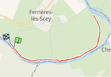
Trail Walking of 5.4 km to be discovered at Bourgogne-Franche-Comté, Haute-Saône, Ferrières-lès-Scey. This trail is proposed by michelelfn.
Description
Saône
Positioning
Country:
France
Region :
Bourgogne-Franche-Comté
Department/Province :
Haute-Saône
Municipality :
Ferrières-lès-Scey
Location:
Unknown
Start:(Dec)
Start:(UTM)
725033 ; 5281669 (31T) N.
Comments