


pragnereysG2

LouisROGER
User GUIDE

Length
12.3 km

Max alt
1605 m

Uphill gradient
721 m
Km-Effort
22 km

Min alt
909 m

Downhill gradient
721 m
Boucle
Yes
Creation date :
2020-06-19 07:19:28.665
Updated on :
2020-06-25 14:55:30.016
5h44
Difficulty : Very easy

FREE GPS app for hiking
 SityTrail
IGN / Geographical institutes
SityTrail Plus
The world is yours!
About
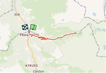
Trail Walking of 12.3 km to be discovered at Occitania, Hautespyrenees, Gavarnie-Gèdre. This trail is proposed by LouisROGER.
Positioning
Country:
France
Region :
Occitania
Department/Province :
Hautespyrenees
Municipality :
Gavarnie-Gèdre
Location:
Gèdre
Start:(Dec)
Start:(UTM)
255569 ; 4745214 (31T) N.
Comments