


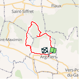
ARGILLIERS - LES DARBOUNELLES - 11.5Km - 03h30 - Dénivelé 199 m

dansmabulle
User


3h02
Difficulty : Easy

FREE GPS app for hiking
 SityTrail
IGN / Geographical institutes
SityTrail Plus
The world is yours!
About
Trail Walking of 11.5 km to be discovered at Occitania, Gard, Argilliers. This trail is proposed by dansmabulle.
Description
ARGILLIERS - LES DARBOUNELLES
11.5Km - 03:30
Départ randonnée : Village d'Argilliers (Gard 30) Carte IGN serie bleue 2941ouest.Balisage partiel jaune. Remonter la grand rue d'Argillier et suivre a gauche "Bornègre" . Avant le pont romain (vestige de l'aqueduc du Pont du Gard)prendre à droite pour rejoindre la résurgence de Bornègre et continuer en suivant le fond de la combe . Monter jusqu'au plateau, passer au sud du terrain de sport et chercher dans la végétation la dépression des Darbounelles.Retrouver un bon chemin. s'aider de la trace GPS pour trouver dans la végétation l'aven de castille (attention danger corde et materiel indispensable pour la visite complète).Suivre un moment le balisage et le quitter par la droite pour regagner le village.
Positioning
Comments