


embrun chemin de ceinture

mcterret
User
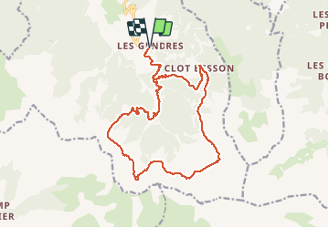

Length
19.3 km

Max alt
2191 m

Uphill gradient
843 m
Km-Effort
30 km

Min alt
1567 m

Downhill gradient
843 m
Boucle
Yes
Creation date :
2020-06-21 07:02:17.353
Updated on :
2020-06-22 07:51:48.7
9h54
Difficulty : Difficult

FREE GPS app for hiking
 SityTrail
IGN / Geographical institutes
SityTrail Plus
The world is yours!
About
Trail Walking of 19.3 km to be discovered at Provence-Alpes-Côte d'Azur, Hautes-Alpes, Crots. This trail is proposed by mcterret.
Description
Difficile en cas de névé. Pour bon randonneur
Positioning
Country:
France
Region :
Provence-Alpes-Côte d'Azur
Department/Province :
Hautes-Alpes
Municipality :
Crots
Location:
Unknown
Start:(Dec)
Start:(UTM)
299572 ; 4929456 (32T) N.
Comments