


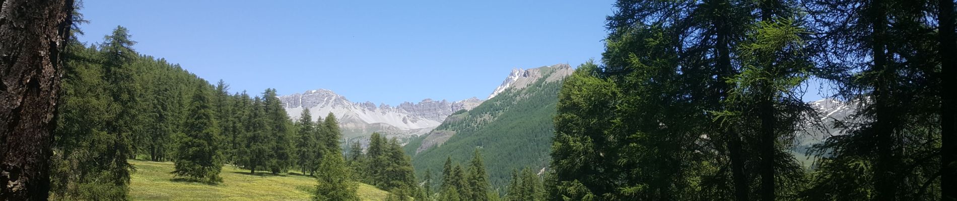
refuge Les Fonts à Chalp

jeff2
User
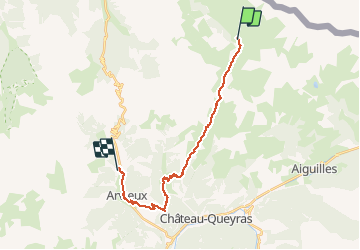

Length
22 km

Max alt
2636 m

Uphill gradient
868 m
Km-Effort
35 km

Min alt
1532 m

Downhill gradient
1248 m
Boucle
No
Creation date :
2020-06-22 04:58:26.454
Updated on :
2020-06-22 13:50:35.128
7h01
Difficulty : Difficult

FREE GPS app for hiking
 SityTrail
IGN / Geographical institutes
SityTrail Plus
The world is yours!
About
Trail Winter toboggan of 22 km to be discovered at Provence-Alpes-Côte d'Azur, Hautes-Alpes, Cervières. This trail is proposed by jeff2.
Description
Très bucolique, un refuge à chalp bien sympatoche. Le tiepo
Photos


Positioning
Country:
France
Region :
Provence-Alpes-Côte d'Azur
Department/Province :
Hautes-Alpes
Municipality :
Cervières
Location:
Unknown
Start:(Dec)
Start:(UTM)
327391 ; 4967999 (32T) N.
Comments