


Fontaine_Berger_Suchet_Clierzou

jagarnier
User GUIDE
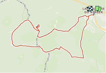

Length
13.3 km

Max alt
1221 m

Uphill gradient
535 m
Km-Effort
20 km

Min alt
927 m

Downhill gradient
535 m
Boucle
Yes
Creation date :
2020-06-23 07:23:19.106
Updated on :
2025-04-18 07:37:07.428
4h00
Difficulty : Difficult

FREE GPS app for hiking
 SityTrail
IGN / Geographical institutes
SityTrail Plus
The world is yours!
About
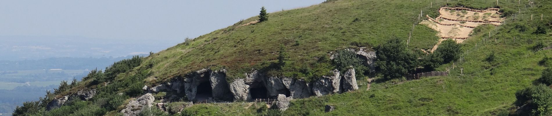
Trail Walking of 13.3 km to be discovered at Auvergne-Rhône-Alpes, Puy-de-Dôme, Orcines. This trail is proposed by jagarnier.
Photos


Positioning
Country:
France
Region :
Auvergne-Rhône-Alpes
Department/Province :
Puy-de-Dôme
Municipality :
Orcines
Location:
Unknown
Start:(Dec)
Start:(UTM)
499352 ; 5071695 (31T) N.
Comments