


camping isoard lacs marion

mcterret
User

Length
13.5 km

Max alt
2509 m

Uphill gradient
758 m
Km-Effort
24 km

Min alt
1833 m

Downhill gradient
758 m
Boucle
Yes
Creation date :
2020-06-24 08:06:27.492
Updated on :
2020-06-25 05:46:40.645
6h55
Difficulty : Medium

FREE GPS app for hiking
 SityTrail
IGN / Geographical institutes
SityTrail Plus
The world is yours!
About
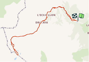
Trail Walking of 13.5 km to be discovered at Provence-Alpes-Côte d'Azur, Hautes-Alpes, Arvieux. This trail is proposed by mcterret.
Positioning
Country:
France
Region :
Provence-Alpes-Côte d'Azur
Department/Province :
Hautes-Alpes
Municipality :
Arvieux
Location:
Unknown
Start:(Dec)
Start:(UTM)
319406 ; 4963198 (32T) N.
Comments