


Malleval-en-Vercors

jpblimond
User
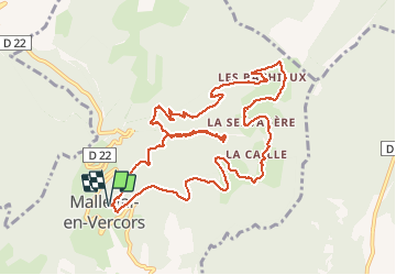

Length
12.5 km

Max alt
1232 m

Uphill gradient
676 m
Km-Effort
22 km

Min alt
787 m

Downhill gradient
676 m
Boucle
Yes
Creation date :
2020-06-25 09:39:58.304
Updated on :
2020-06-25 16:26:01.377
5h18
Difficulty : Medium

FREE GPS app for hiking
 SityTrail
IGN / Geographical institutes
SityTrail Plus
The world is yours!
About
Trail Walking of 12.5 km to be discovered at Auvergne-Rhône-Alpes, Isère, Malleval-en-Vercors. This trail is proposed by jpblimond.
Positioning
Country:
France
Region :
Auvergne-Rhône-Alpes
Department/Province :
Isère
Municipality :
Malleval-en-Vercors
Location:
Unknown
Start:(Dec)
Start:(UTM)
691707 ; 5002299 (31T) N.
Comments