


menée le natal le jocou

Joel26400
User
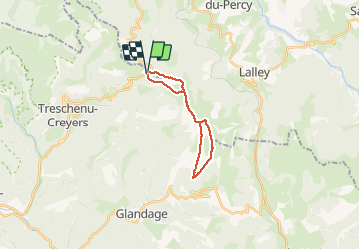

Length
17.3 km

Max alt
2036 m

Uphill gradient
1255 m
Km-Effort
34 km

Min alt
1398 m

Downhill gradient
1260 m
Boucle
Yes
Creation date :
2020-06-25 05:58:42.729
Updated on :
2020-06-25 16:58:27.949
8h56
Difficulty : Difficult

FREE GPS app for hiking
 SityTrail
IGN / Geographical institutes
SityTrail Plus
The world is yours!
About
Trail Walking of 17.3 km to be discovered at Auvergne-Rhône-Alpes, Drôme, Châtillon-en-Diois. This trail is proposed by Joel26400.
Description
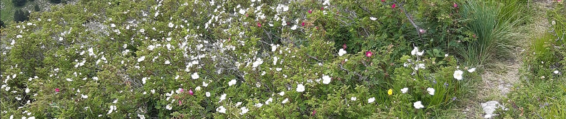
aérien en crêtes. panorama
Photos


Positioning
Country:
France
Region :
Auvergne-Rhône-Alpes
Department/Province :
Drôme
Municipality :
Châtillon-en-Diois
Location:
Treschenu-Creyers
Start:(Dec)
Start:(UTM)
705959 ; 4959238 (31T) N.
Comments