


Vacherie de Rimplas

frizou83
User
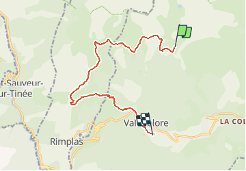

Length
12.8 km

Max alt
2119 m

Uphill gradient
415 m
Km-Effort
21 km

Min alt
996 m

Downhill gradient
1369 m
Boucle
No
Creation date :
2020-06-26 15:54:07.537
Updated on :
2020-06-26 15:54:46.058
3h50
Difficulty : Difficult

FREE GPS app for hiking
 SityTrail
IGN / Geographical institutes
SityTrail Plus
The world is yours!
About
Trail Walking of 12.8 km to be discovered at Provence-Alpes-Côte d'Azur, Maritime Alps, Valdeblore. This trail is proposed by frizou83.
Positioning
Country:
France
Region :
Provence-Alpes-Côte d'Azur
Department/Province :
Maritime Alps
Municipality :
Valdeblore
Location:
Unknown
Start:(Dec)
Start:(UTM)
354842 ; 4884394 (32T) N.
Comments