


marnha c

Mas12
User
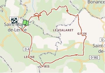

Length
13.2 km

Max alt
722 m

Uphill gradient
347 m
Km-Effort
17.8 km

Min alt
488 m

Downhill gradient
336 m
Boucle
Yes
Creation date :
2014-12-10 00:00:00.0
Updated on :
2014-12-10 00:00:00.0
4h05
Difficulty : Very easy

FREE GPS app for hiking
 SityTrail
IGN / Geographical institutes
SityTrail Plus
The world is yours!
About
Trail Other activity of 13.2 km to be discovered at Occitania, Aveyron, Saint-Martin-de-Lenne. This trail is proposed by Mas12.
Positioning
Country:
France
Region :
Occitania
Department/Province :
Aveyron
Municipality :
Saint-Martin-de-Lenne
Location:
Unknown
Start:(Dec)
Start:(UTM)
497460 ; 4919681 (31T) N.
Comments