


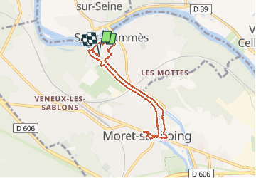
st mammes moret

Yannick.Boireau
User

Length
6.9 km

Max alt
58 m

Uphill gradient
46 m
Km-Effort
7.6 km

Min alt
42 m

Downhill gradient
47 m
Boucle
Yes
Creation date :
2020-06-26 07:47:41.974
Updated on :
2020-06-27 05:38:23.124
2h42
Difficulty : Very easy

FREE GPS app for hiking
 SityTrail
IGN / Geographical institutes
SityTrail Plus
The world is yours!
About
Trail Walking of 6.9 km to be discovered at Ile-de-France, Seine-et-Marne, Saint-Mammès. This trail is proposed by Yannick.Boireau.
Positioning
Country:
France
Region :
Ile-de-France
Department/Province :
Seine-et-Marne
Municipality :
Saint-Mammès
Location:
Unknown
Start:(Dec)
Start:(UTM)
485529 ; 5359220 (31U) N.
Comments