


Chapelle Saint Donat

frizou83
User

Length
4.6 km

Max alt
1077 m

Uphill gradient
251 m
Km-Effort
7.9 km

Min alt
817 m

Downhill gradient
251 m
Boucle
Yes
Creation date :
2020-06-28 05:59:57.322
Updated on :
2020-06-28 06:00:34.097
1h36
Difficulty : Medium

FREE GPS app for hiking
 SityTrail
IGN / Geographical institutes
SityTrail Plus
The world is yours!
About
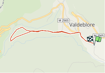
Trail Walking of 4.6 km to be discovered at Provence-Alpes-Côte d'Azur, Maritime Alps, Valdeblore. This trail is proposed by frizou83.
Positioning
Country:
France
Region :
Provence-Alpes-Côte d'Azur
Department/Province :
Maritime Alps
Municipality :
Valdeblore
Location:
Unknown
Start:(Dec)
Start:(UTM)
353885 ; 4880851 (32T) N.
Comments