


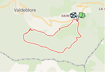
Circuit du bois Noir

frizou83
User

Length
7.9 km

Max alt
1549 m

Uphill gradient
452 m
Km-Effort
14 km

Min alt
1088 m

Downhill gradient
456 m
Boucle
Yes
Creation date :
2020-06-28 15:37:25.688
Updated on :
2020-06-28 15:38:05.37
2h49
Difficulty : Difficult

FREE GPS app for hiking
 SityTrail
IGN / Geographical institutes
SityTrail Plus
The world is yours!
About
Trail Walking of 7.9 km to be discovered at Provence-Alpes-Côte d'Azur, Maritime Alps, Valdeblore. This trail is proposed by frizou83.
Positioning
Country:
France
Region :
Provence-Alpes-Côte d'Azur
Department/Province :
Maritime Alps
Municipality :
Valdeblore
Location:
Unknown
Start:(Dec)
Start:(UTM)
356092 ; 4880724 (32T) N.
Comments