


Les quatre lacs avec les CDR

Regisconraud
User
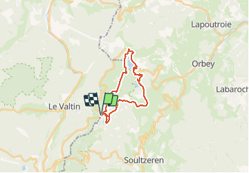

Length
21 km

Max alt
1304 m

Uphill gradient
785 m
Km-Effort
31 km

Min alt
952 m

Downhill gradient
784 m
Boucle
Yes
Creation date :
2020-06-28 06:58:54.092
Updated on :
2020-06-28 18:47:00.695
7h39
Difficulty : Very easy

FREE GPS app for hiking
 SityTrail
IGN / Geographical institutes
SityTrail Plus
The world is yours!
About
Trail Walking of 21 km to be discovered at Grand Est, Vosges, Le Valtin. This trail is proposed by Regisconraud.
Positioning
Country:
France
Region :
Grand Est
Department/Province :
Vosges
Municipality :
Le Valtin
Location:
Unknown
Start:(Dec)
Start:(UTM)
355600 ; 5328449 (32U) N.
Comments