


GTJ Menthieres - refuge de la loge

svp59
User

Length
18.4 km

Max alt
1710 m

Uphill gradient
1051 m
Km-Effort
31 km

Min alt
1069 m

Downhill gradient
689 m
Boucle
No
Creation date :
2014-12-10 00:00:00.0
Updated on :
2014-12-10 00:00:00.0
6h44
Difficulty : Medium

FREE GPS app for hiking
 SityTrail
IGN / Geographical institutes
SityTrail Plus
The world is yours!
About
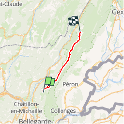
Trail Walking of 18.4 km to be discovered at Auvergne-Rhône-Alpes, Ain, Chézery-Forens. This trail is proposed by svp59.
Description
Refuge de la Loge Lelex
Positioning
Country:
France
Region :
Auvergne-Rhône-Alpes
Department/Province :
Ain
Municipality :
Chézery-Forens
Location:
Unknown
Start:(Dec)
Start:(UTM)
719801 ; 5117364 (31T) N.
Comments