


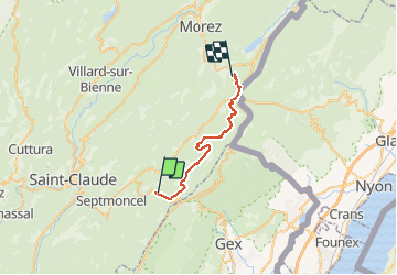
GTJ Lajoux - Les Rousses

svp59
User

Length
23 km

Max alt
1492 m

Uphill gradient
649 m
Km-Effort
32 km

Min alt
1105 m

Downhill gradient
710 m
Boucle
No
Creation date :
2014-12-10 00:00:00.0
Updated on :
2014-12-10 00:00:00.0
6h55
Difficulty : Medium

FREE GPS app for hiking
 SityTrail
IGN / Geographical institutes
SityTrail Plus
The world is yours!
About
Trail Walking of 23 km to be discovered at Bourgogne-Franche-Comté, Jura, Lajoux. This trail is proposed by svp59.
Description
Les Rousses le Gai Pinson .
Positioning
Country:
France
Region :
Bourgogne-Franche-Comté
Department/Province :
Jura
Municipality :
Lajoux
Location:
Unknown
Start:(Dec)
Start:(UTM)
728467 ; 5140172 (31T) N.
Comments