


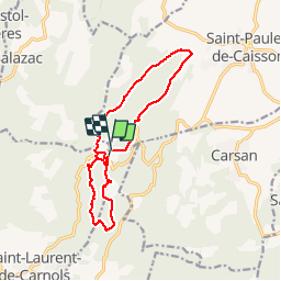
30 - LA CHARTREUSE DE VALBONNE - 14.3 Km - 04h30 Heures – D 400 m

dansmabulle
User


4h11
Difficulty : Difficult

FREE GPS app for hiking
 SityTrail
IGN / Geographical institutes
SityTrail Plus
The world is yours!
About
Trail Walking of 14.3 km to be discovered at Occitania, Gard, Saint-Michel-d'Euzet. This trail is proposed by dansmabulle.
Description
30 - LA CHARTREUSE DE VALBONNE14.3 Km - 04h30 Heures – D 300 m
Départ randonnée : Parking devant la chartreuse de Valbonne (Gard 30) Parking devant la chartreuse de Valbonne ensuite nous avons l' un de nous qui connaît cette rando.Nous l' avons suivi durant la journée environ 15kms.Dans un paysage qui n' est pas le notre mais joli tout de même.Bonne randonnée
Positioning
Comments