


cascade st Laurent rouans

guy07
User

Length
69 km

Max alt
448 m

Uphill gradient
1036 m
Km-Effort
83 km

Min alt
107 m

Downhill gradient
1104 m
Boucle
No
Creation date :
2020-06-30 07:38:35.059
Updated on :
2020-07-02 06:03:39.209
4h42
Difficulty : Very easy

FREE GPS app for hiking
 SityTrail
IGN / Geographical institutes
SityTrail Plus
The world is yours!
About
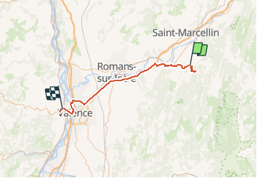
Trail Walking of 69 km to be discovered at Auvergne-Rhône-Alpes, Isère, Pont-en-Royans. This trail is proposed by guy07.
Positioning
Country:
France
Region :
Auvergne-Rhône-Alpes
Department/Province :
Isère
Municipality :
Pont-en-Royans
Location:
Unknown
Start:(Dec)
Start:(UTM)
684010 ; 4992760 (31T) N.
Comments