


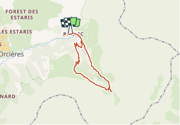
2020-07-02 Saut du Laire

Bernardb44
User

Length
12.4 km

Max alt
2069 m

Uphill gradient
562 m
Km-Effort
19.8 km

Min alt
1536 m

Downhill gradient
536 m
Boucle
No
Creation date :
2020-07-02 06:29:22.495
Updated on :
2020-07-02 13:36:47.859
5h37
Difficulty : Medium

FREE GPS app for hiking
 SityTrail
IGN / Geographical institutes
SityTrail Plus
The world is yours!
About
Trail Walking of 12.4 km to be discovered at Provence-Alpes-Côte d'Azur, Hautes-Alpes, Orcières. This trail is proposed by Bernardb44.
Positioning
Country:
France
Region :
Provence-Alpes-Côte d'Azur
Department/Province :
Hautes-Alpes
Municipality :
Orcières
Location:
Unknown
Start:(Dec)
Start:(UTM)
291315 ; 4952260 (32T) N.
Comments