


guai des sableurs col du menil

Joel26400
User
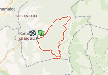

Length
16.2 km

Max alt
1301 m

Uphill gradient
1037 m
Km-Effort
30 km

Min alt
528 m

Downhill gradient
1031 m
Boucle
Yes
Creation date :
2020-07-02 05:54:13.084
Updated on :
2020-07-02 18:15:18.725
7h36
Difficulty : Medium

FREE GPS app for hiking
 SityTrail
IGN / Geographical institutes
SityTrail Plus
The world is yours!
About
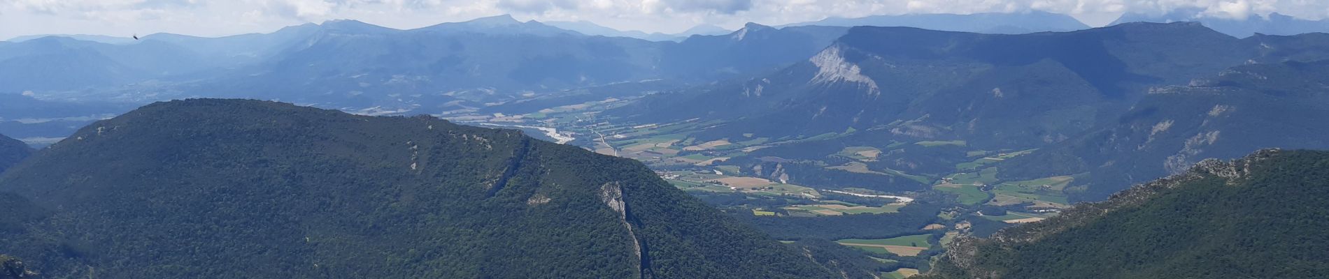
Trail Walking of 16.2 km to be discovered at Auvergne-Rhône-Alpes, Drôme, Romeyer. This trail is proposed by Joel26400.
Description
toute à l'ombre
Photos


Positioning
Country:
France
Region :
Auvergne-Rhône-Alpes
Department/Province :
Drôme
Municipality :
Romeyer
Location:
Unknown
Start:(Dec)
Start:(UTM)
691451 ; 4960648 (31T) N.
Comments