


les granges raguin

PatriceCocuaud
User
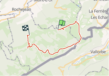

Length
12.3 km

Max alt
1450 m

Uphill gradient
320 m
Km-Effort
17 km

Min alt
1145 m

Downhill gradient
452 m
Boucle
No
Creation date :
2020-07-06 11:41:02.766
Updated on :
2020-07-06 15:55:56.112
4h14
Difficulty : Easy

FREE GPS app for hiking
 SityTrail
IGN / Geographical institutes
SityTrail Plus
The world is yours!
About
Trail Walking of 12.3 km to be discovered at Bourgogne-Franche-Comté, Doubs, Rochejean. This trail is proposed by PatriceCocuaud.
Positioning
Country:
France
Region :
Bourgogne-Franche-Comté
Department/Province :
Doubs
Municipality :
Rochejean
Location:
Unknown
Start:(Dec)
Start:(UTM)
296224 ; 5178515 (32T) N.
Comments