


Clignon - Col Encombettre - Clignon

soca
User
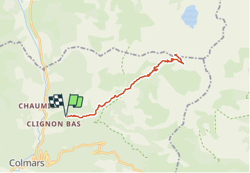

Length
15.7 km

Max alt
2540 m

Uphill gradient
1052 m
Km-Effort
30 km

Min alt
1506 m

Downhill gradient
1052 m
Boucle
Yes
Creation date :
2020-07-06 16:00:02.473
Updated on :
2020-07-06 16:01:01.106
5h57
Difficulty : Difficult

FREE GPS app for hiking
 SityTrail
IGN / Geographical institutes
SityTrail Plus
The world is yours!
About
Trail Walking of 15.7 km to be discovered at Provence-Alpes-Côte d'Azur, Alpes-de-Haute-Provence, Colmars. This trail is proposed by soca.
Positioning
Country:
France
Region :
Provence-Alpes-Côte d'Azur
Department/Province :
Alpes-de-Haute-Provence
Municipality :
Colmars
Location:
Unknown
Start:(Dec)
Start:(UTM)
311954 ; 4896552 (32T) N.
Comments