


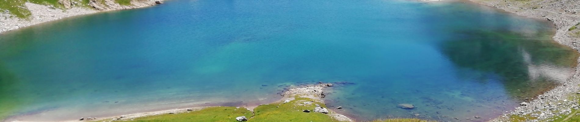
vallée de la Clarée- col des Rochilles AR

laurentnecca
User
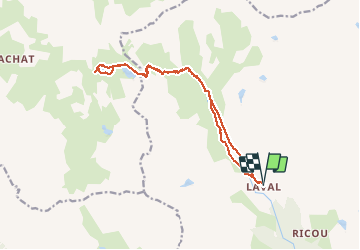

Length
16 km

Max alt
2491 m

Uphill gradient
537 m
Km-Effort
23 km

Min alt
2004 m

Downhill gradient
537 m
Boucle
Yes
Creation date :
2020-07-06 08:16:50.106
Updated on :
2020-07-07 07:48:01.697
4h55
Difficulty : Medium

FREE GPS app for hiking
 SityTrail
IGN / Geographical institutes
SityTrail Plus
The world is yours!
About
Trail Walking of 16 km to be discovered at Provence-Alpes-Côte d'Azur, Hautes-Alpes, Névache. This trail is proposed by laurentnecca.
Photos


Positioning
Country:
France
Region :
Provence-Alpes-Côte d'Azur
Department/Province :
Hautes-Alpes
Municipality :
Névache
Location:
Unknown
Start:(Dec)
Start:(UTM)
305399 ; 4992365 (32T) N.
Comments