


05 - NEVACHE

AndreLACOMBE
User

Length
12.6 km

Max alt
2590 m

Uphill gradient
597 m
Km-Effort
21 km

Min alt
2021 m

Downhill gradient
598 m
Boucle
Yes
Creation date :
2020-07-08 07:48:07.235
Updated on :
2020-07-08 16:13:23.365
7h51
Difficulty : Difficult

FREE GPS app for hiking
 SityTrail
IGN / Geographical institutes
SityTrail Plus
The world is yours!
About
Trail Walking of 12.6 km to be discovered at Provence-Alpes-Côte d'Azur, Hautes-Alpes, Névache. This trail is proposed by AndreLACOMBE.
Description
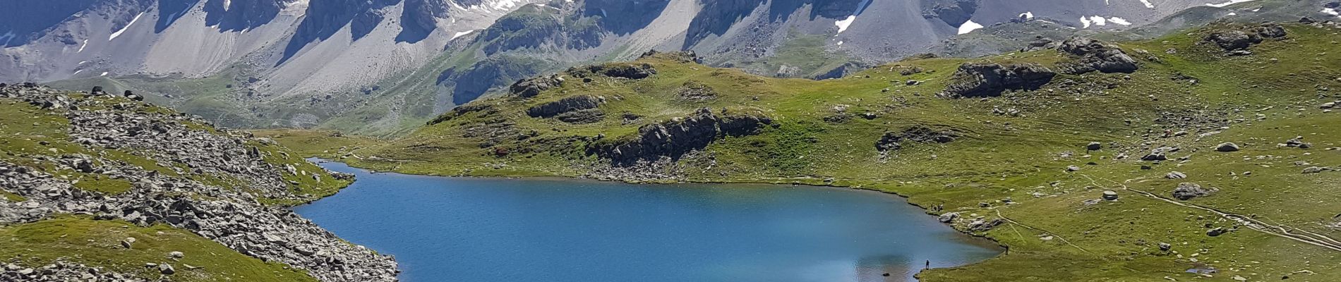
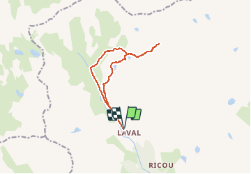
Parking chalets de Laval.
Montée au lac Rond depuis Drayères. Puis lac des Muandes, retour au lac Rond, lac Long et descente directe à Laval.
Photos


Positioning
Country:
France
Region :
Provence-Alpes-Côte d'Azur
Department/Province :
Hautes-Alpes
Municipality :
Névache
Location:
Unknown
Start:(Dec)
Start:(UTM)
305224 ; 4992475 (32T) N.
Comments