


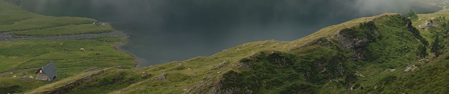
Lac D'oo Lac d'Espingo

kephas
User
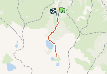

Length
12 km

Max alt
1973 m

Uphill gradient
862 m
Km-Effort
23 km

Min alt
1143 m

Downhill gradient
862 m
Boucle
Yes
Creation date :
2020-07-10 07:17:37.923
Updated on :
2020-07-10 13:19:57.122
6h00
Difficulty : Difficult

FREE GPS app for hiking
 SityTrail
IGN / Geographical institutes
SityTrail Plus
The world is yours!
About
Trail Walking of 12 km to be discovered at Occitania, Haute-Garonne, Oô. This trail is proposed by kephas.
Photos


Positioning
Country:
France
Region :
Occitania
Department/Province :
Haute-Garonne
Municipality :
Oô
Location:
Unknown
Start:(Dec)
Start:(UTM)
295629 ; 4737634 (31T) N.
Comments