Trail Walking Plédran - En suivant l'URNE et en passant par le BOIS. - Photo

En suivant l'URNE et en passant par le BOIS.

 Alphe
Alphe

User

© OpenStreetMap contributors
Length
Length
15.2 km
Max alt
Max alt
174 m
Uphill gradient
Uphill gradient
214 m
Km-Effort
Km-Effort  
18 km
Min alt
Min alt
53 m
Downhill gradient
Downhill gradient
214 m
Boucle
Boucle
Yes
Creation date :
2020-07-12 08:51:59.331
Updated on :
2020-07-12 11:53:39.536

(1 Reviews)

Walking
Walking
2h16
Difficulty : Medium

Scan this QR Code to open this trail in the SityTrail application

FREE GPS app for hiking

Logo SityTrail SityTrail

IGN / Geographical institutes

Download SityTrail from the App Store Download SityTrail from Google Play

Logo SityTrail SityTrail World

The world is yours!

Download SityTrail from the App Store Download SityTrail from Google Play Download SityTrail on Huawei AppGallery

About

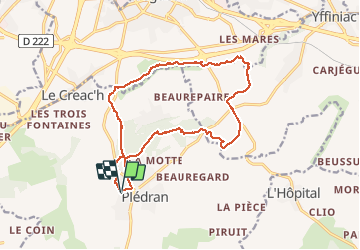
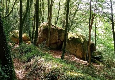
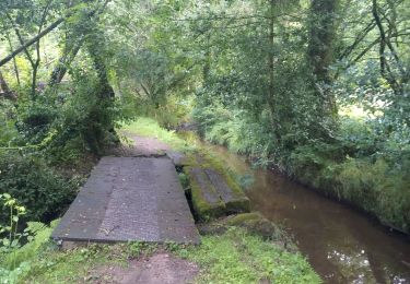
Trail Walking of 15.2 km to be discovered at Brittany, Côtes-d'Armor, Plédran. This trail is proposed by Alphe.

Description

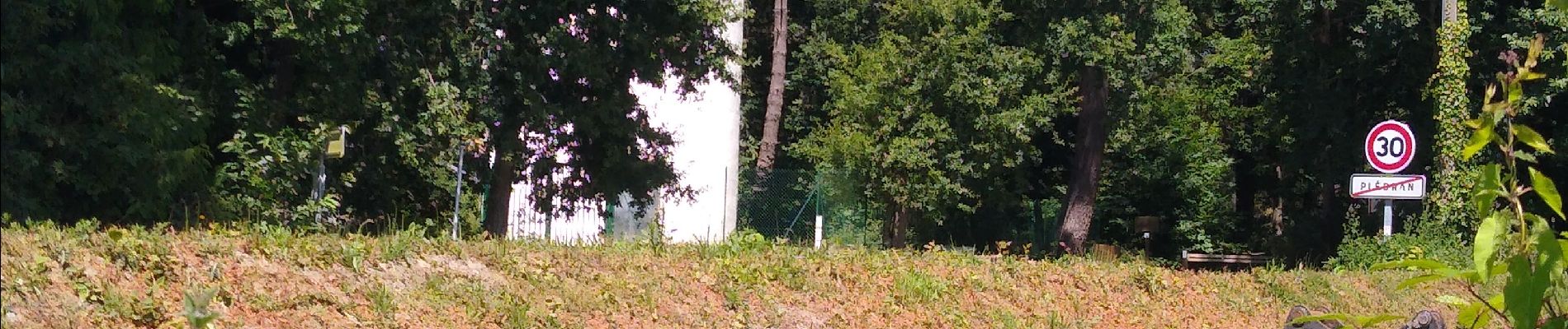
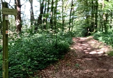
Depart rue du Challonge, en bas traverser le lotissement, traverser la rue des lilas et prendre le bois jusqu'au château d'eau, descendre ce chemin du bois jusqu'en bas, traverser la route de St-Brieuc et prendre le sentier au ras de la maison jusque l'Urne ( pont romain) continuer jusqu'à la route , la traverser et prendre direction usine traitement d'eau. continuer, traverser le cours d'eau sur un pont, continuer , retraverser sur un deuxième pont et monter tout droit vers la carrière, prendre route a droite et continuer jusque croix Bertrand, tourner à gauche  , passer le rond-point et continuer 400 m, puis a droite et tout droit jusqu'au plan d'eau, faire le tour par la gauche et remonter vers le parking de l'hippodrome,, sur la gauche prendre sentier vers la chapelle, remonter va vers le bois en prenant première route au rond-point, a 50 m prendre le bois a gauche, tout droit et arrivé sur allée principale, la remonter jusqu'au château d'eau et retour au départ.

Elevation profile

Photos

Positioning

Country:
France
Region :
Brittany
Department/Province :
Côtes-d'Armor
Municipality :
Plédran
Location:
Unknown
Start:(UTM)
518504 ; 5365714 (30U) N.

Comments

Please log in to post a review or rate the element


Très bien


Trails nearby

Trail Bicycle tourism Saint-Carreuc - 4 étapes en Bretagne à vélo  - Photo
Bicycle tourism
nadd73

Bicycle tourism

Medium
Saint-Carreuc, Brittany, Côtes-d'Armor, France
172 km | 200 km-effort
16h 10min
No
Trail Walking Plaintel - Au bois des Mauriers. N 2 - Photo
Walking
Alphe

Walking

Medium
Plaintel, Brittany, Côtes-d'Armor, France
6.5 km | 8.1 km-effort
1h 55min
Yes
Trail Walking Plaintel - Les Mauriers par le chemin des fées. - Photo
Walking
Alphe

Walking

Very easy
Plaintel, Brittany, Côtes-d'Armor, France
3.3 km | 4.6 km-effort
1h 3min
Yes
Trail Running Saint-Carreuc - la ville mereuc 1 - Photo
Running
nadd73

Running

Very easy
Saint-Carreuc, Brittany, Côtes-d'Armor, France
9 km | 11.1 km-effort
58min
Yes
Trail Walking Ploufragan - Les vallées  - Photo
Walking
Vauvert

Walking

Very easy
Ploufragan, Brittany, Côtes-d'Armor, France
9.2 km | 10.3 km-effort
1h 56min
Yes
Trail Walking Saint-Julien - Découverte en bois de St- Julien. - Photo
Walking
Alphe

Walking

Medium
Saint-Julien, Brittany, Côtes-d'Armor, France
5.1 km | 6.3 km-effort
1h 6min
Yes
Trail Walking Plédran - Entre histoire, fil de l'eau et forêt. - Photo
Walking
Alphe

Walking

Very easy
Plédran, Brittany, Côtes-d'Armor, France
12.3 km | 15 km-effort
2h 21min
Yes
Trail Walking Plédran - Bourg de Pledran vers Piruit et retour - Photo
Walking
Alphe

Walking

Very easy
Plédran, Brittany, Côtes-d'Armor, France
7.6 km | 9 km-effort
1h 45min
Yes
Trail Walking Plédran - Pledran, Campagne. - Photo
Walking
Alphe

Walking

Very easy
Plédran, Brittany, Côtes-d'Armor, France
9.4 km | 11.2 km-effort
1h 39min
No


Close
My subscriptions