


Le Col de la Ruchère et le monastère de la Grande Chartreuse 12/07/2020

Isabelle07
User
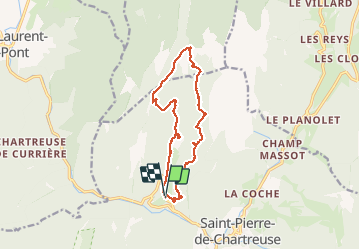

Length
13.8 km

Max alt
1449 m

Uphill gradient
861 m
Km-Effort
25 km

Min alt
859 m

Downhill gradient
860 m
Boucle
Yes
Creation date :
2020-07-12 09:35:08.856
Updated on :
2020-07-12 15:28:52.531
5h35
Difficulty : Medium

FREE GPS app for hiking
 SityTrail
IGN / Geographical institutes
SityTrail Plus
The world is yours!
About
Trail Walking of 13.8 km to be discovered at Auvergne-Rhône-Alpes, Isère, Saint-Pierre-de-Chartreuse. This trail is proposed by Isabelle07.
Positioning
Country:
France
Region :
Auvergne-Rhône-Alpes
Department/Province :
Isère
Municipality :
Saint-Pierre-de-Chartreuse
Location:
Unknown
Start:(Dec)
Start:(UTM)
718534 ; 5025680 (31T) N.
Comments