


Obersteinbach 20200713 finale

baggera
User
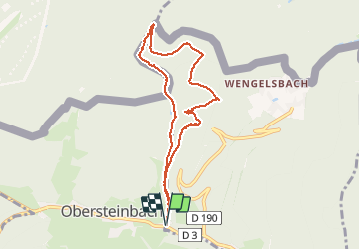

Length
7.7 km

Max alt
411 m

Uphill gradient
234 m
Km-Effort
10.8 km

Min alt
238 m

Downhill gradient
235 m
Boucle
Yes
Creation date :
2020-07-13 09:10:04.392
Updated on :
2020-07-13 13:28:27.634
2h53
Difficulty : Easy

FREE GPS app for hiking
 SityTrail
IGN / Geographical institutes
SityTrail Plus
The world is yours!
About
Trail Walking of 7.7 km to be discovered at Grand Est, Bas-Rhin, Niedersteinbach. This trail is proposed by baggera.
Positioning
Country:
France
Region :
Grand Est
Department/Province :
Bas-Rhin
Municipality :
Niedersteinbach
Location:
Unknown
Start:(Dec)
Start:(UTM)
404824 ; 5432165 (32U) N.
Comments