


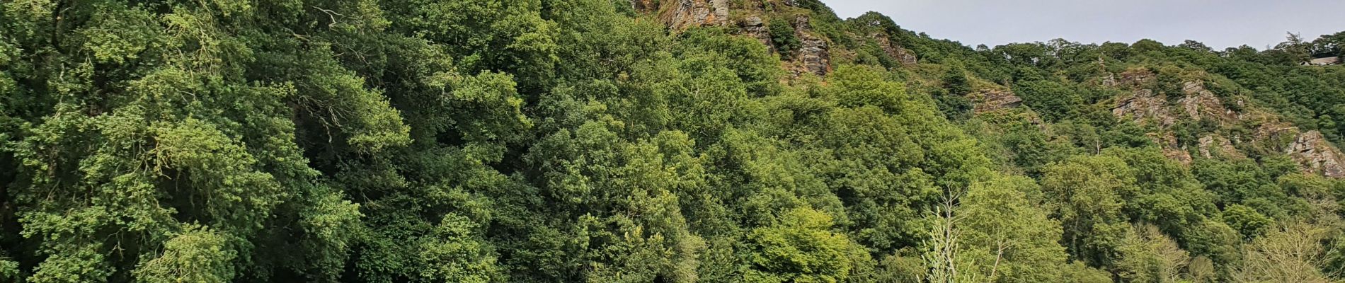
Le rocher de Ham

prv
User
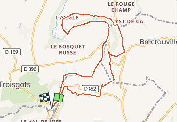

Length
10.9 km

Max alt
111 m

Uphill gradient
181 m
Km-Effort
13.4 km

Min alt
25 m

Downhill gradient
181 m
Boucle
Yes
Creation date :
2020-07-13 12:35:36.829
Updated on :
2020-07-14 13:17:54.071
2h24
Difficulty : Easy

FREE GPS app for hiking
 SityTrail
IGN / Geographical institutes
SityTrail Plus
The world is yours!
About
Trail Walking of 10.9 km to be discovered at Normandy, Manche, Condé-sur-Vire. This trail is proposed by prv.
Description
belle balade le long de la Vire. avec une pause crêpes à mi parcours. Pas désagréable :-)
Photos


Positioning
Country:
France
Region :
Normandy
Department/Province :
Manche
Municipality :
Condé-sur-Vire
Location:
Troisgots
Start:(Dec)
Start:(UTM)
641848 ; 5429909 (30U) N.
Comments
un bon moment dans un cadre idyllique. la randonnée offre une pause crêpes pas désagréable avec une vue superbe sur la vallée